This page is an article on the 2011 Atlantic hurricane season. For the forums, see Forum:2011 Atlantic hurricane season.

If you disagree with its speedy deletion, please explain why at the article's talk page or improve the page and then remove the {{Delete}} tag.
Remember to check what links here and the page history before deleting.
| First storm formed | June 29, 2011 |
| Last storm dissipated | November 12, 2011 |
| Strongest storm | Ophelia, 140 mph (220 km/h), 940 mbar (27.77 inHg) |
| Total depressions | 20 |
| Total storms | 19 |
| Hurricanes | 7 |
| Major hurricanes | 4 |
| Total damages | >$19.2 billion (2011 USD) |
| Total fatalities | 118 total |
The 2011 Atlantic hurricane season was an annual event when most tropical and subtropical cyclones formed in the year 2011, starting on June 1, and ending on November 30. Should've any tropical or subtropical cyclones formed in the off-season, it would've been still considered as a part of the season.
During the season, 20 depressions formed, 19 became named storms, 7 became hurricanes and 4 became major hurricanes. In terms of named storms, 2011 was the third most active season ever, behind 2005 (28 storms) and 1933 (20 storms), and tied with 1887, 1995, 2010, and 2012.
Storms[]

Tropical Storm Arlene[]
Main article: Tropical Storm Arlene (2011)
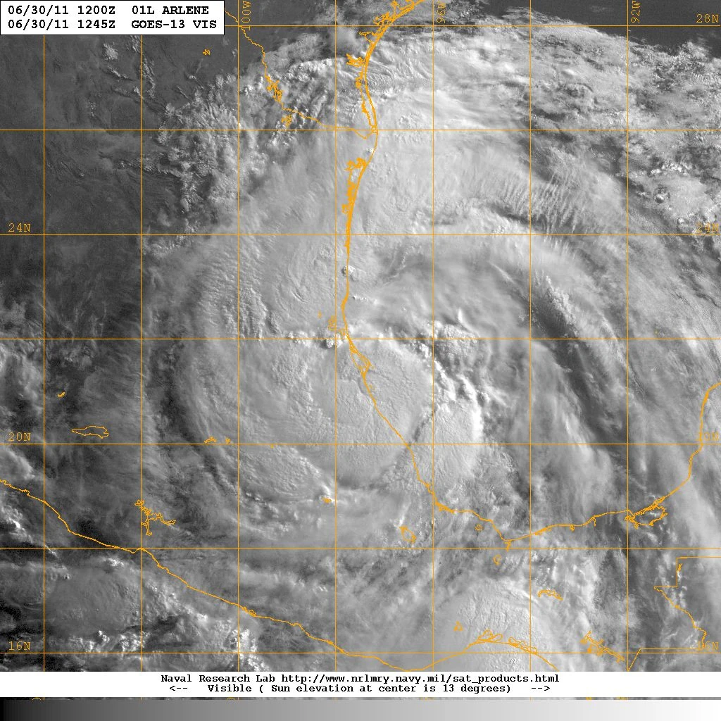
Tropical Storm Arlene was a tropical cyclone that existed from June 29 to July 1. It made landfall near Cabo Rojo, Mexico. The cyclone killed 25 people and left moderate damage behind.
Tropical Storm Bret[]
Main article: Tropical Storm Bret (2011)

Tropical Storm Bret was a tropical cyclone that existed from July 17 to July 22. It did not make landfall, and had minimal effects on land.
Tropical Storm Cindy[]
Main article: Tropical Storm Cindy (2011)
Tropical Storm Cindy existed from July 20 to 23. It never affected land.
Tropical Storm Don[]
Main article: Tropical Storm Don (2011)

Tropical Storm Don was the first storm to make landfall in the United States since Bonnie of 2010, and the first on the Texas coast since Ike of 2008. Don formed on July 27 out of a strong tropical wave that moved off the coast of Africa 10 days earlier. Skipping tropical depression status, the tropical storm moved in a general northeast direction. The next day, however, Don made a sudden jog to the west, greatly altering the forecast track. The track change would not be for long as the storm resumed its previous position. ...to be edited.
Tropical Storm Emily[]
Storm article: Tropical Storm Emily (2011)
Wave article: Invest 91L (July 2011)


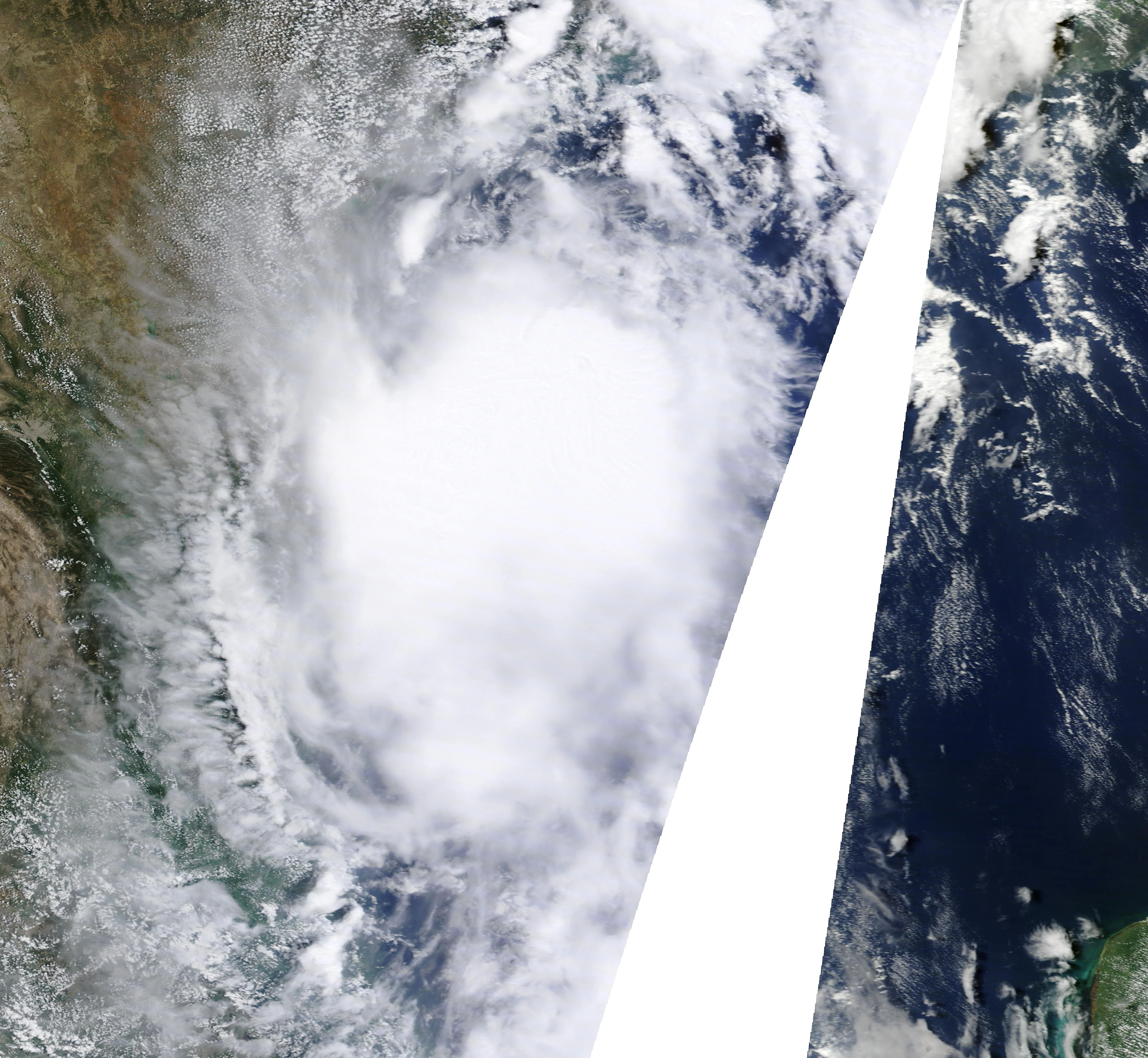
Emily on August 2
Tropical Storm Emily was a tropical cyclone that existed from August 1 to August 7. It affected the Lesser Antilles, Hispaniola, and Cuba, and the Eastern Seaboard. There was an indirect death related to Emily.
Tropical Storm Franklin[]

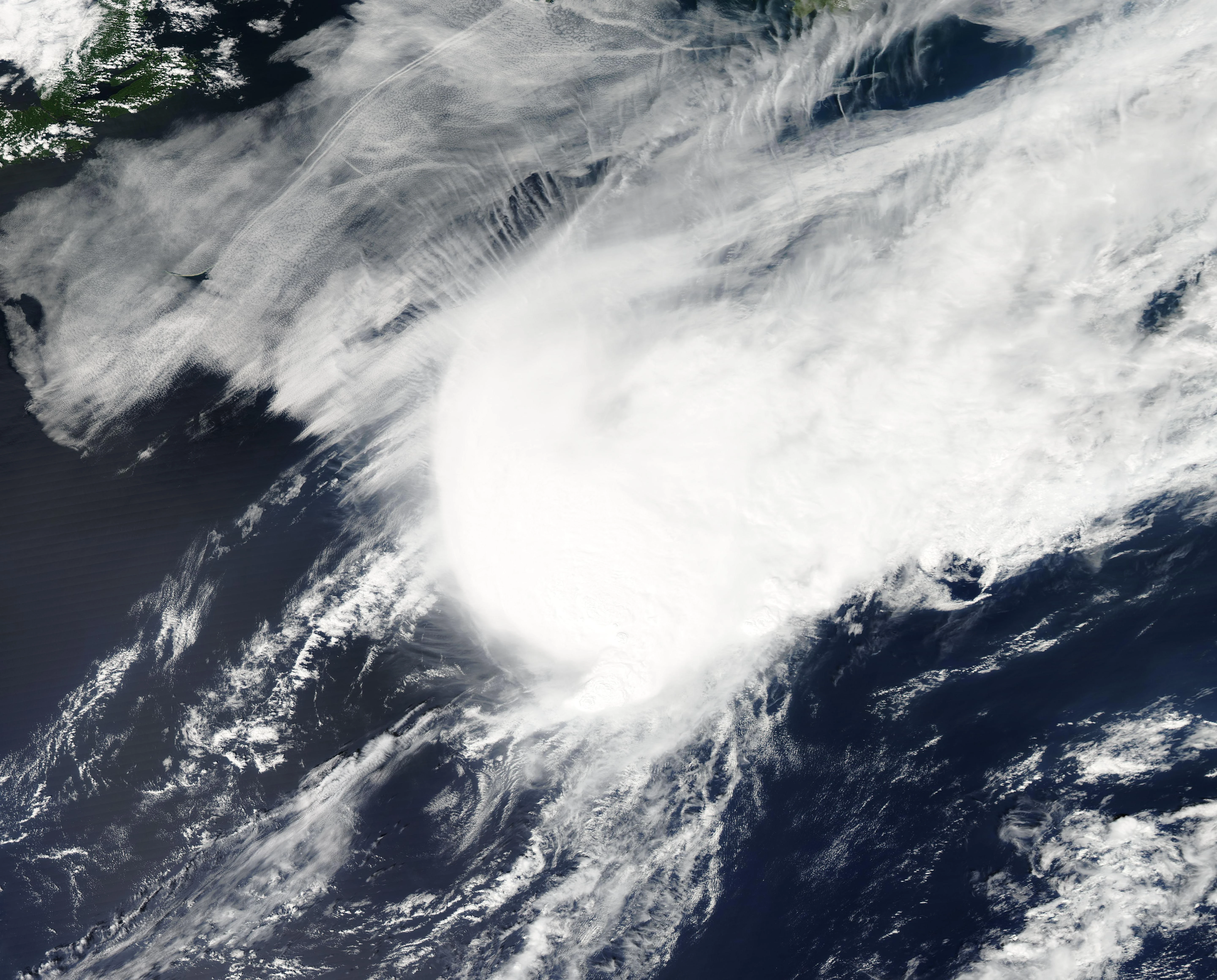
Tropical Storm Franklin on August 13
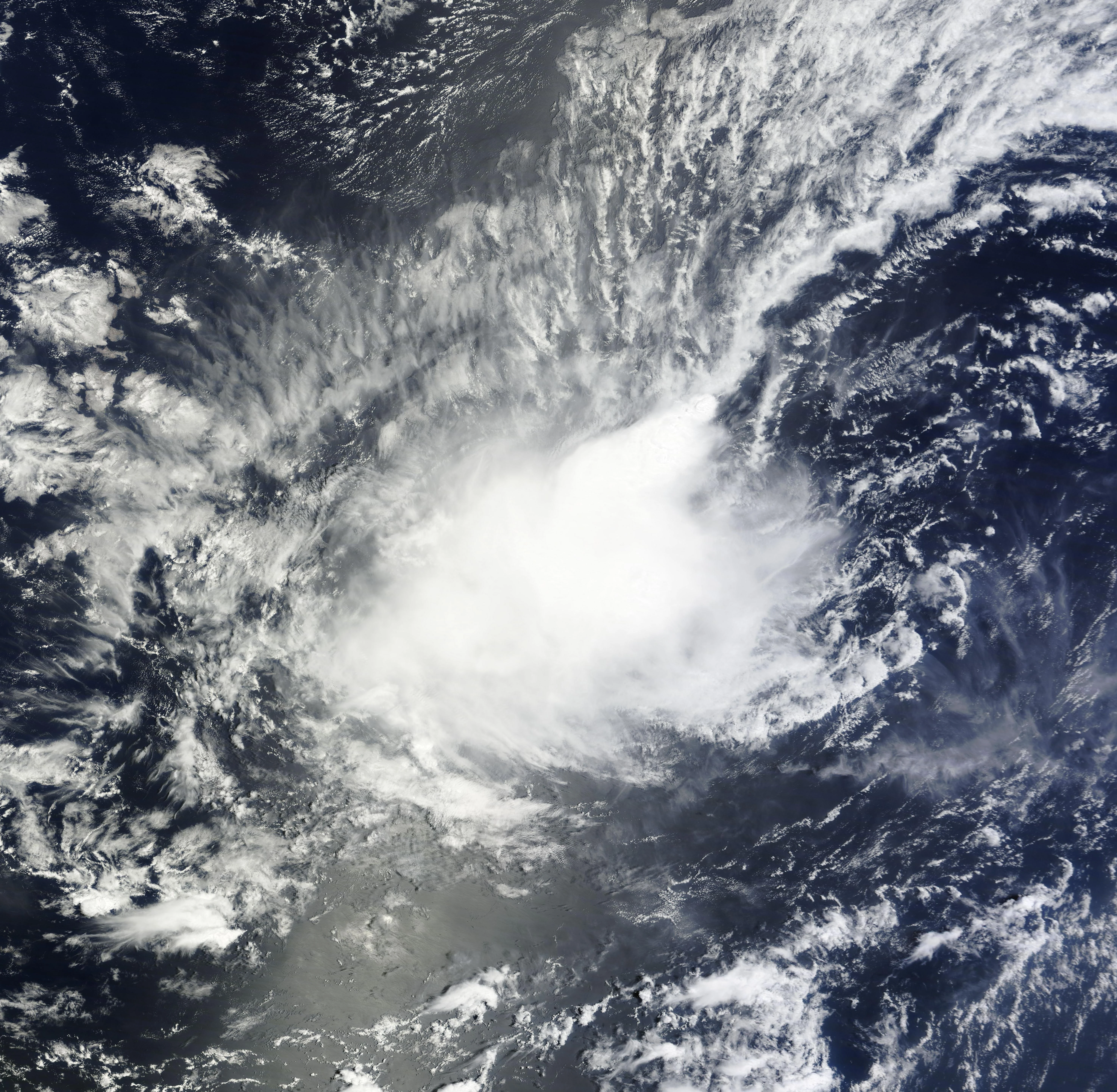
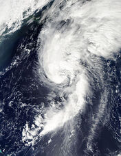
Tropical Storm Franklin was a weak and short lived tropical system that never affected land. The persercusor to Franklin moved off the Florida coast on August 10. It was soon designated Invest 95L as it moved in a general northeast direction. Then, late on August 12, the disturbance lost enough frontal characteristics to be designated as Tropical Depression Six. After dinural minimum, the depression had a burst of convection and was then classified as Tropical Storm Franklin, the fifth storm of the season. Franklin continued to move northeast into cooler waters, and did not strengthen much. On August 13, the storm became extratropical after only being tropical for 30 hours. Forming on August 12, Franklin was the fourth earliest date that the fifth storm formed.
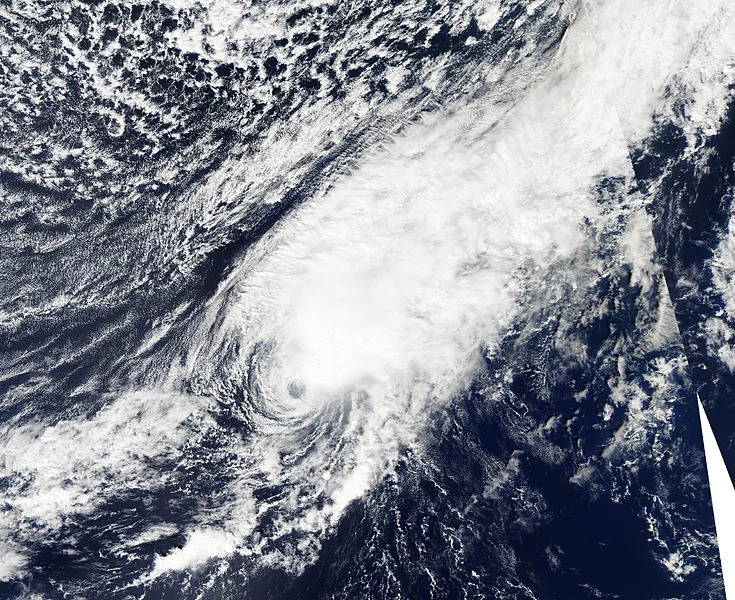
Tropical Storm Gert[]


Tropical Storm Gert at peak intensity on August 15.
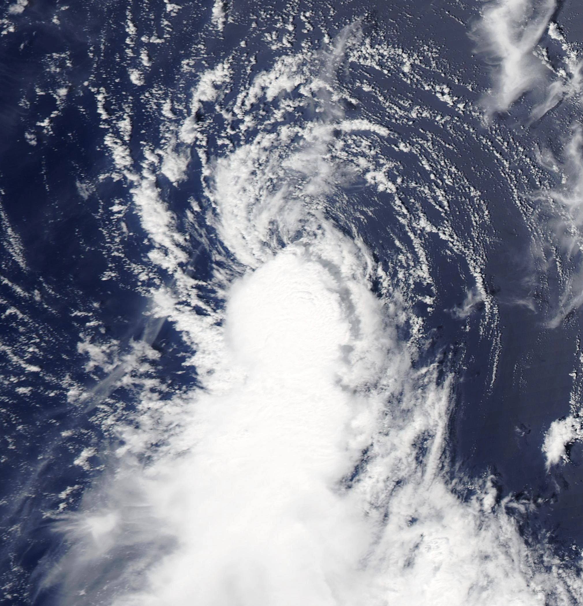
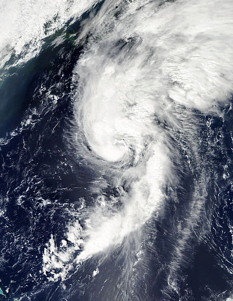
Tropical Storm Gert was a short lived storm that formed out of a tropical wave known as Invest 94L on August 13. Gert moved west and then curved north, approaching Bermuda while steadily strengthening. On August 15, the storm reached peak intensity with wind speeds of 60 mph and a minimum pressure of 1000 mbar. Later that day, Gert made its closest approach to Bermuda at 95 miles away from the island. The tropical storm continued to move to the northeast the next day as it progressed into unfavorable conditions. Gert degenerated into a remnant low on August 16. When Gert formed on August 13, it was the fourth earliest date that the seventh storm formed, only behind Gabrielle of 1995, the seventh hurricane of 1936, and Gert of 2005.
Tropical Storm Harvey[]
Main article: Tropical Storm Harvey (2011)

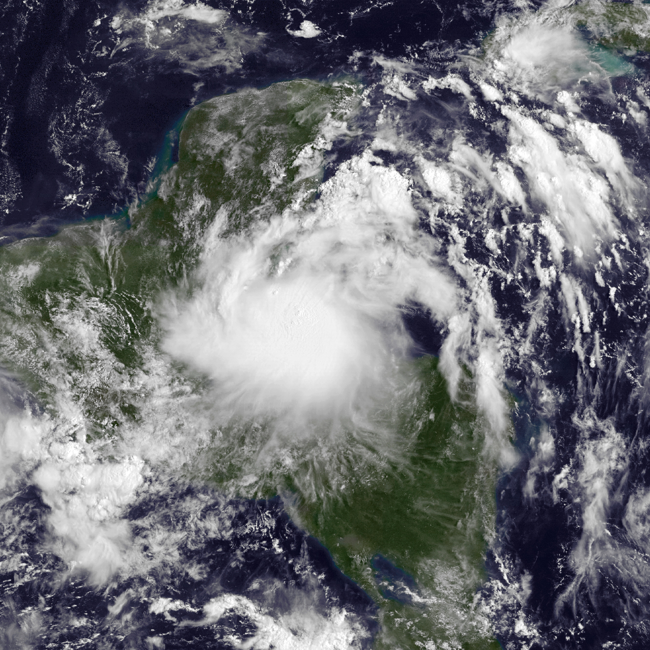
Harvey making landfall
Tropical Storm Harvey was the eighth consecutive tropical storm since the start of the season. Harvey formed out of a strong tropical wave on August 18 that only began to develop quickly in the Western Caribbean. Harvey moved mostly parallel to the Honduran coast for much of its exsistence. It was able to intensify into a 65 mph tropical storm before making landfall on Dangriga, Belize on August 20. Harvey weakened into a tropical depression as it moved through Belize, Guatamala, and then the Yucatan Peninsula. After causing heavy rains on Central America, Harvey defied most forecasts by emerging into the southern Bay of Campheche while still a tropical cyclone. The storm only intensified somewhat, remaining a tropical depression before making landfall on Veracruz, Mexico on August 22. Harvey soon dissapated over the Sierra Madre Mountains later that day When Harvey formed on August 18, it was the fourth earliest date that the seventh storm formed, only behind the eighth storm of 1933 and 1936, respectively, and Harvey of 2005.
Hurricane Irene[]
Wikipedia article: Hurricane Irene

Hurricane Irene as a category 3 on August 24
Hurricane Wiki article: Hurricane Irene
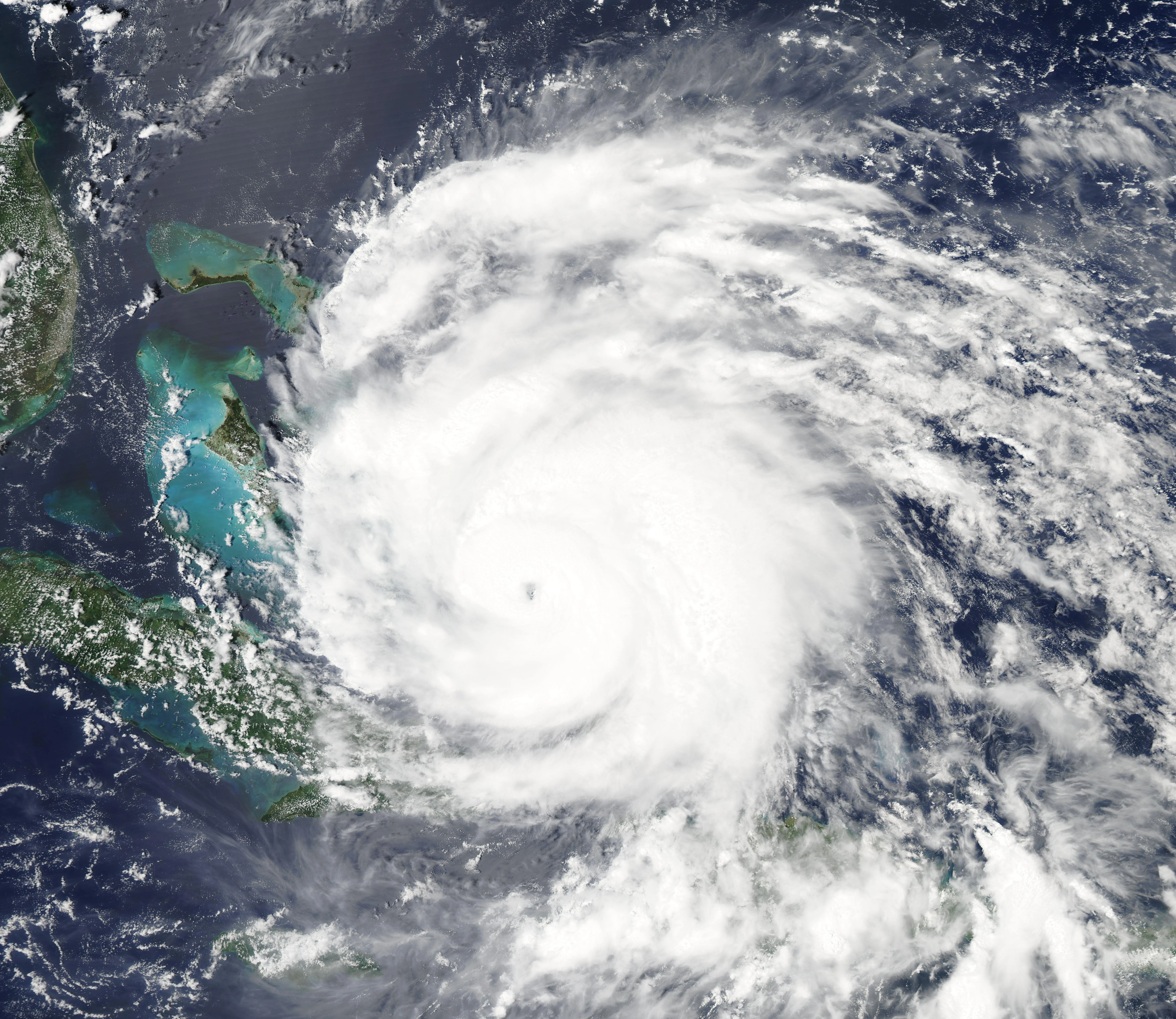
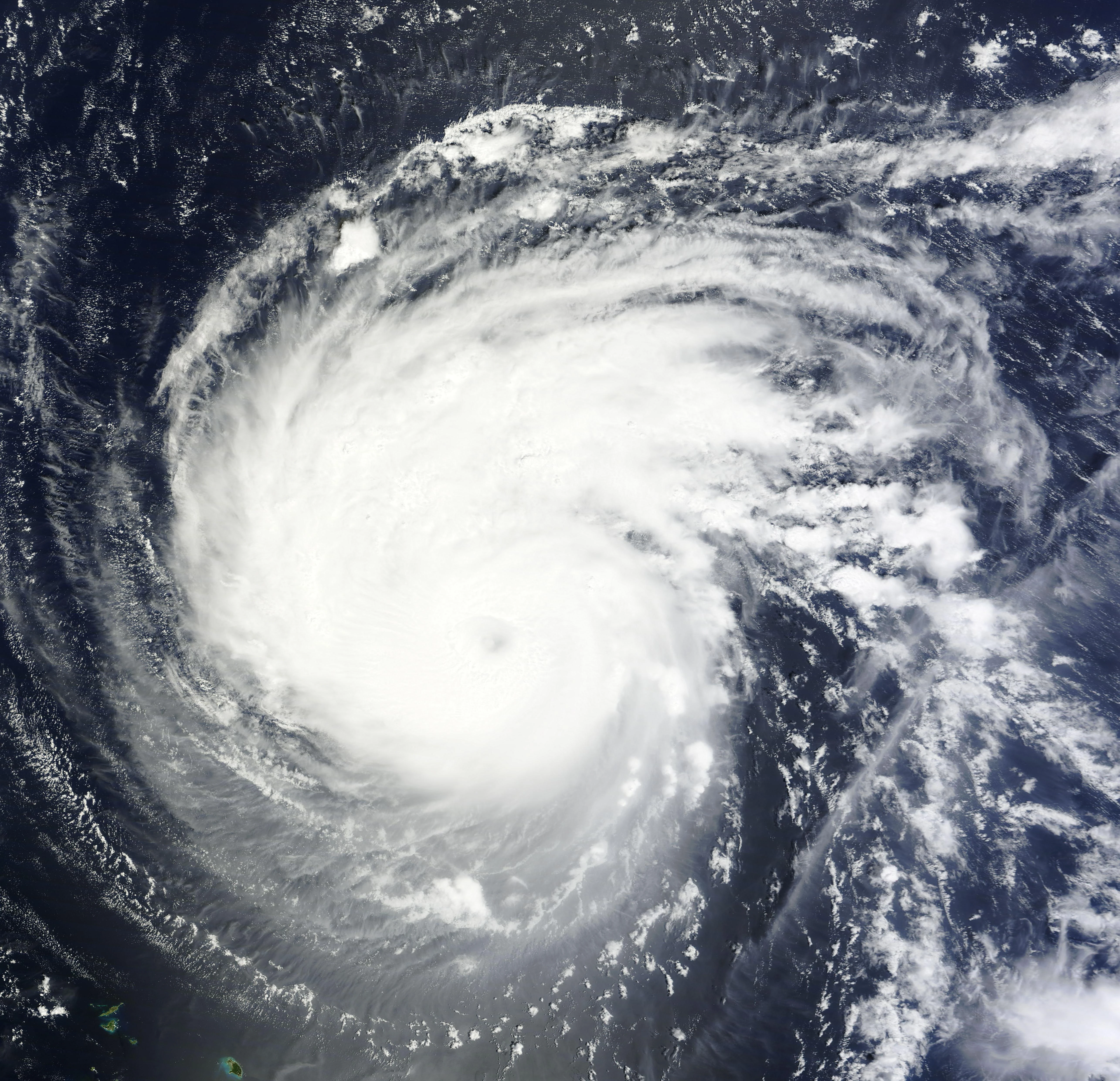
Hurricane Irenewas a devestating, damaging, and deadly tropical cyclone. Irene formed from a large tropical wave which traversed the Atlantic in mid-August. The disturbance became better and better organized and was designated as Tropical Storm Irene on August 20 while situated 190 miles east of Dominica. Irene moved west at a rapid clip, making landfall on the northern part of Guadeloupe early the next day. Originally forecast to make landfall on Hispaniola, Irene abruptly moved more northerly in response to a strong subtropical ridge maintaining strength. The storm guadually strengthened to a strong tropical storm before making landfall on Puerto Rico at 1 AM EDT on August 22. Depsite interaction with land and the mountainious terrain of the island, Irene strengthened, with a ragged eye appearing on radar and better defined banding features. After spending 4 hours on the island, the storm immediately intensified to a minimal category 1 hurricane on the north Puerto Rican shore, thus ending the record tropical storm streak that lasted since the beginning of the hurricane season. Irene continued to strengthen as it moved in a general WNW direction, intensifying to a category 2. However, the hurricane temporarily weakened back to a category 1 before restrengthening early on August 24. Irene continued strengthening throughout the day, reaching major hurricane status that afternoon before passing directly over Crooked Island, the Bahamas. Soon, the hurricane executed a curve to the northwest and north as forecast by the National Hurricane Center. As such, Irene continued to force damage over the rest of the Bahamas.


Hurricane Irene at landfall
Late on August 24, the major hurricane underwent what appeared to be an eyewall replacement cycle. However, as a result, Irene enlarged in size and deepened in pressure but its wind speeds were not reflected in the overall intensity of the cyclone due to the extremely vast wind field. Past hurricanes in which this occured include Hurricane Alex of 2010 and Hurricane Ike of 2008. Despite being in favorable conditions, dry air from Georgia entered the hurricane, weakening it to a category 1 storm as it made landfall near Cape Lookout, North Carolina at 1130 UTC on August 27. After its landfall, Irene spent 11 hours over land, before emerging into Chesapeake Bay. Irene then made a second landfall as a tropical storm over Little Egg Inlet, New Jersey. Continuing northeastward, Irene moved through New Jersey and made a third landfall near Coney Island, Brooklyn, New Jersey. It then moved inland over New England and became post-tropical on August 29. When Irene formed on the 20th of August, it was the third earliest date for a season's ninth storm. Only the ninth storm of 1936 and 2005's Irene formed earlier.
Tropical Depression Ten[]

Ten over open waters
Tropical Depression Tenwas a short lived tropical depression that existed over the open waters of the Atlantic. Forming on August 25 from a tropical wave, the storm was originally forecast to become Jose. Quickly gaining organization at first, the tropical depression soon succumbed to cooler SSTs and high vertical wind shear. Tropical Depression Ten degenerated into a trough of low pressure a day after it formed. The remnants of the tropical depression moved to the northwest and created an area of disorganized showers the next day with up to a 10% chance of regeneration, however, convection died down and the area of low pressure completely dissipated.
Tropical Storm Jose[]
Jose near Bermuda
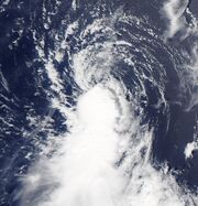
Tropical Storm Jose formed on August 28 from a wave which tracked off of Africa and moved to the Bermuda area before organizing into a tropical system. After attaining tropical storm force winds for over 12 hours, the wave formed in Tropical Storm Jose, the eleventh named storm of the season. After being named, Jose brushed Bermuda, prompting a tropical storm warning, but missed the island and dissipated on August 29. Only 2005's Jose, Jerry in 1995, and the tenth nameable storm of 1933 formed earlier.
Hurricane Katia[]
Main article: Hurricane Katia (2011)

Katia moving across the Atlantic
Hurricane Katia was a tropical cyclone that existed from August 29 to September 10. It affected the Leewrd Islands, Bermuda, and Europe. When Katia formed on August 29, it was the fifth earliest date for a season's eleventh storm. Only 2005's Katrina, Karen in 1995, and the eleventh nameable storms of 1936 and 1933 formed earlier.
Tropical Storm Lee[]
Main article: Tropical Storm Lee (2011)
Wikipedia article:Tropical Storm Lee (2011)

Lee strengthening off the Gulf Coast
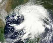
Tropical Storm Lee was a tropical cyclone that caused lots of rainfall. Forming from a trough of low pressure that existed in the western Caribbean as well as the Gulf of Mexico, the trough became better defined to become the thirteenth storm of the season on September 1. The elongated system slowly intensified as it slugged west and then north torward the Gulf Coast. Due to the dry air present over Texas, Lee maintained an area of limited to no shower activity on the west side of the system. Weak steering currents caused Lee to stall near the Louisiana coast, providing additional rainfall before making landfall on September 4. Lee quickly dissapated as it moved northeastwards, its remnants causing flooding to much of the Midwest and Appalachian States.
Unnamed Tropical Storm[]
On September 1, a tropical storm formed south-east of Novia Scotia. The storm was previously unnoticed by the National Hurricane Center. This storm was the second earliest 13th named storm in any season, after Maria in 2005.
Hurricane Maria[]
Main article: Hurricane Maria (2011)
Hurricane Maria at peak intensity.
Hurricane Maria was a tropical cyclone that existed from September 7 to September 16. At first it was classified as Tropical Depression Fourteen. It moved WNW until it reached the Caribbean and started to move NW. The tropical storm moved north then NNE. Just north-west of Bermuda, Maria became a Category 1 hurricane. It continued north-east and then struck Newfoundland as a hurricane. Shortly after landfall, Maria became post-tropical. When Maria formed on September 7th, it was the second earliest date for a season's fourteenth named storm. Only Nate in 2005 formed earlier.
Hurricane Nate[]
Main article: Hurricane Nate (2011)
Hurricane Nate existed from September 7 to September 12. It affected Southern Mexico. Five deaths have been reported due to the system. Due to dry air over Mexico, Nate completely dissipated when it made landfall just like Don. In Nate's Tropical Cyclone Report (TCR), it was upgraded to a Category 1 hurricane based on data from PEMEX oil rigs. When Nate formed on September 7, it was the second earliest date for a season's fifteenth named storm. Only Ophelia in 2005 formed earlier.
Hurricane Ophelia[]
Main article: Hurricane Ophelia (2011)
Wikipedia article: Hurricane Ophelia (2011)
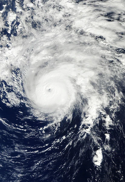

Hurricane Ophelia was a tropical cyclone that existed from September 21 until October 3. It continued west until it got ripped apart by wind shear on September 25. Just 2 days later, Ophelia regenerated into a tropical depression. As time went by, Ophelia was upgraded into a tropical storm and then a category 1 hurricane. On September 30, Ophelia strengthened into a Category 2 hurricane and then a Category 3 major hurricane. On the next day, Ophelia reached its peak with 140 mph winds and a pressure of 940 mbar, making it the strongest storm of the season. As it moved further north, it weakened due to low sea temperatures. It made landfall in Newfoundland on October 3 and became a post-tropical storm shortly after. When Ophelia formed on September 21, it was the second earliest date for a season's sixteenth named storm, after Philippe in 2005.
Hurricane Philippe[]
Main article: Hurricane Philippe (2011)

Hurricane Philippe was a long lasting tropical cyclone. It formed on September 23 as Tropical Depression Seventeen. It continued to move north-west. The National Hurricane Center described this storm as an intensity rollercoaster. After 12 days as a Tropical Storm, it finally became a Category 1 hurricane on October 6. But after interacting with a cold front, the hurricane weakened back into a tropical storm the next day. Lasting over 13 days, Philippe is the longest-lived hurricane since Bertha in 2008. On October 8 after moving over water temperatures of just 18C, Philippe became post-tropical. When Philippe formed on September 24, it marked the second earliest date for a season's seventeenth storm. Only Rita in 2005 formed earlier. This also is only the sixth of seven occurences of a 'P' storm in a season. Pablo, Peter, 2005's Philippe, Paloma, Paula, and Patty are the only other 'P' storms.
Hurricane Rina[]
Main article: Hurricane Rina (2011)
Hurricane Wiki article: Hurricane Rina (2011)
Hurricane Rina existed from October 24 to October 28. It affected Honduras (paticuarly the Swan Islands), Nicaragua, and the Yucatan (paticuarly Quintana Roo). No damages or deaths have been reported. It was operationally thought to be a Category 2 hurricane, until post-storm analysis upgraded it into the fourth major hurricane of the season.
When Rina became named on October 24, it was the fourth of five uses of an 'R' name in the North Atlantic, after Roxanne, Rita, and Richard, and preceding Rafael.
Tropical Storm Sean[]
Main article: Tropical Storm Sean (2011)
A non-tropical low developed into Subtropical Storm Sean on November 8. However, it quickly gained tropical characteristics and transitioned into a tropical cyclone later that day.
On November 12, Sean lost its tropical characteristics and became post-tropical.
The name Sean is only the fourth 'S' name on record to be used in the North Atlantic Ocean. The only other 'S' names used are Sebastien, Stan, and Shary (later on the name Sandy was used).
Storm names[]

|
This page section uses content from Wikipedia. The original article is located here. The list of authors can be seen in the [{{{2}}} page history]. As with Hurricane Wiki, the text of Wikipedia is available under the GNU Free Documentation License. |
The following names were used for tropical storms, subtropical storms and hurricanes that form in the North Atlantic in 2011. Retired names, if any, will be announced by the World Meteorological Organization in the spring of 2012. This list is the same used in the 2005 Atlantic hurricane season, except Don, Katia, Rina, Sean, and Whitney, which respectively replaced Dennis, Katrina, Rita, Stan, and Wilma. Storms were named Don, Katia, Rina and Sean for the first time this year.
Retirement[]
On April 13, 2012, the WMO announced the retirement of the name Irene. The replacement name selected was Irma for the 2017 season.